
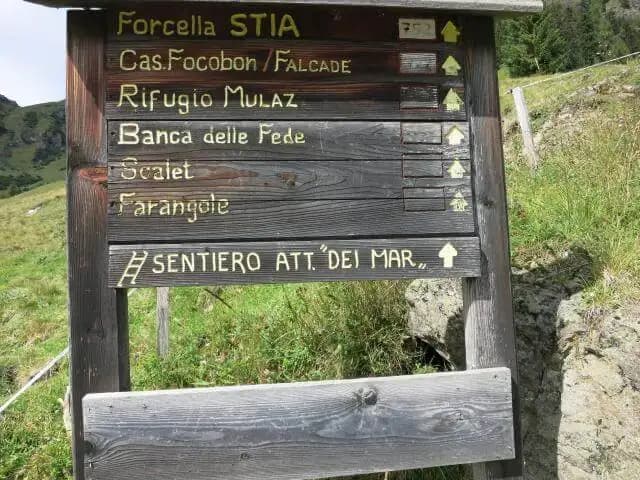
Sentiero Attrezzato dei Mar
Pale di San Martino · Belluno · Italy
Technical data
- Difficulty
- Moderatamente Difficile
- Status
- aperta
- Distance
- 13 km
- Total duration
- 7 h
- Approach
- 1 h 45 min
- Ferrata time
- 1 h 45 min
- Elevation gain
- 1180 m
- Max altitude
- 2560 m
Route planning
How to plan Sentiero Attrezzato dei Mar
Sentiero Attrezzato dei Mar is in Pale di San Martino, Belluno, Italy and is rated Moderatamente Difficile. Available route data lists about 7 h total time, 13 km of distance, 1180 m of elevation gain.
For day planning, consider an approach of about 105 min, about 105 min on the cable, a maximum altitude near 2560 m. Reported route features include: Itinerario lungo.
The page includes a parking or driving-directions reference. A GPX track is not available yet, so bring an alternative map source.
As with every via ferrata, evaluate season, lingering snow, storms, crowds and equipment condition. Page last updated on 7/4/2026.
Features
Description
Overview
The Sentiero Attrezzato dei Mar is a relatively secluded route that runs along the northern flank of the Pale di San Martino, starting from the hamlet of Gares in the province of Belluno. While it presents no major technical difficulties, the itinerary demands attention for navigation and trail conditions, rewarding you with a magnificent view of the imposing Focobon wall.
The route unfolds mainly along ledges and ridges, alternating grassy sections with dolomite rock slabs. The pace is uneven, characterized by constant ups and downs and a steady but never extreme exposure, making it a scenic, more hiking-oriented than climbing-oriented experience.
Approach
The starting point is Gares. To reach it, drive up the Val d'Agordo, pass through Taibon, and arrive at Cencenighe, where you turn left (west) toward Falcade. Once in Canale d'Agordo, follow the signs left (south) for Gares, taking a road of about 7 km that penetrates a side valley to the parking area. From there, on foot, reach the church and begin the route.
From Gares, follow the signs for Malga Stia. The approach starts on a dirt road to a junction: you can continue right on the dirt road, or, the recommended option, go straight onto the steeper but more direct trail 754, which climbs the left side of the Val di Greta. This brings you to Malga Stia (1785 m) in about 50 minutes from the parking area.
From Malga Stia, take trail 752, which gently ascends through meadows toward Forcella Stia. After about 30 minutes of walking, the profile of the Cresta dei Mar begins to appear. You proceed without obstacles until you gain the wide grassy saddle of Forcella della Stia (2190 m), with an excellent view of the Campanili del Focobon. The travel time from Malga Stia is about 1 hour, for a total of 1 hour and 45 minutes from the start. It is advisable to put on your via ferrata gear already at this point, even though the first equipped sections are mostly horizontal.
The approach is physical but steady, with a constant elevation gain that prepares you for the altitude. The environment is classic Dolomitic, with grassy slopes giving way to scree and rock outcrops as you near the saddle.
Via Ferrata
From the saddle, head toward the Cresta dei Mar. You reach a metal ladder with a sign, marking the start of the equipped sections. After climbing the ladder, traverse a first narrow ledge. Then continue along a grassy ridge, following a faint trail, staying slightly below the rocky crest line. It is essential to pay attention to the ground, which can be grassy, earthy, and slippery, especially after recent rain. Climb a few steeper sections, always protected by cable, up to a beautiful viewpoint at 2300 meters.
The route winds along the side of the ridge, offering a continuous but not strenuous experience. The progression is pleasant, with short, well-spaced technical passages breaking up the trail walking.
From here, cross an exposed but not difficult grassy ridge, descending slightly. The trail is enjoyable; a couple of short equipped sections go around corners before leading to the summit of Punta dei Mar (2365 m). The travel time from Forcella Stia is about 1 hour, for a total of 2 hours and 45 minutes.
The route continues magnificently, dominated by the view of the imposing Focobon wall. Reaching the base of the Campanile del Lastei, the equipped descent begins, which is the most technically significant section of the itinerary. You descend on sloping walls and equipped slabs on the western side of the campanile, tackling a couple of vertical and more challenging passages, though still not difficult. You lose altitude steeply down to a narrow trail with an occasionally unstable surface, leading to Col de Pedoci (2237 m). Here the Sentiero Attrezzato dei Mar officially ends, beneath the bulk of Monte Mulaz. The time from Forcella Stia is about 1 hour and 45 minutes, for a total of 3 hours and 30 minutes.
This final section radically changes the character of the itinerary: from an airy, scenic route, it shifts to a technical, focused descent on vertical slabs, requiring greater attention in managing the rope and your movements.
From Col dei Pedoci, as suggested in this report, you can continue left on the steep trail 722 to reach Rifugio Volpi al Mulaz (2560 m) in about 45 minutes, bringing the total time to about 4 hours and 15 minutes.
Descent
The fastest descent back to Gares involves retracing trail 722 from the refuge down to Col dei Pedoci (about 30 minutes). From there, continue descending on trail 722 to a junction, where you leave 722 and take trail 752 to the right, which leads back to Forcella di Stia (about 1 hour and 30 minutes from the refuge). From the saddle, retrace the approach trail downhill to Gares (about 1 hour and 15 minutes), for a total descent of about 2 hours and 45 minutes from the refuge and a total hike of about 7 hours.
The standard descent is long but not technical, a hiking return that allows you to admire the slopes climbed on the way up from a different perspective.
A more challenging and interesting variant for the return avoids retracing the route. It involves passing through Passo delle Farangole and crossing the Cengia della Fede. This alternative itinerary, not to be underestimated, features equipped and exposed sections, as well as unprotected stretches. It takes about 4 hours and 30 minutes from Rifugio Volpi, for a total of about 8 hours and 30 minutes. It includes exposed equipped passages near Passo delle Farangole and may have persistent snowfields even in high summer. The trail on the Cengia della Fede is very evocative but poorly marked, requiring excellent weather conditions and good navigational sense.
This variant turns the descent into an adventure in its own right, significantly extending the commitment and exposure. It is a route for experts, unfolding in a severe and remote environment where navigation becomes an integral part of the difficulty.
Useful Notes
An important consideration concerns the trail of the Sentiero dei Mar. Not being heavily traveled, the trail is barely visible in some sections, making navigation potentially problematic in fog or poor visibility, even though the route is generally logical. From a technical standpoint, the equipped passages are mostly easy, but require attention due to the dirty ground and occasional overgrowth.
The relative solitude of the route adds to its charm, but demands self-sufficiency. The rock, typical dolomite of the Pale, can be friable in some spots, and the steel cables sometimes blend into the gray of the stone.
For a two-day itinerary combination, you could consider the short and easy Ferrata del Canalino al Mulaz, which runs on the opposite side of Rifugio Volpi and requires proper planning. In the Pale di San Martino, you can also undertake other via ferratas such as the Ferrata Gabitta d'Ignoti, accessible from the opposite side of Passo delle Farangole, or, starting from San Martino di Castrozza, the Ferrata Bolver Lugli a Cima Vezzana, the Ferrata del Porton, the Ferrata del Velo, and the Sentiero Attrezzato Gusella.
Track and weather
Plan the route
Preview the GPX track from the backend, download it for your GPS device, open parking directions, and check a short forecast before leaving.
GPX track unavailable
This route does not include a downloadable track yet.
Images
FAQ
What level of commitment does this via ferrata require?
ferrata.faqAnswers.commitment
How much elevation gain should I plan for?
The listed ferrata elevation gain is 1180 m. Also consider approach, return and maximum altitude, because they can matter more than the equipped section alone.
Where is the route located?
Sentiero Attrezzato dei Mar is located in Pale di San Martino, Belluno, Italy. Before leaving, check parking, access and current local conditions.
When is the best time to climb it?
The best season depends on altitude, aspect and lingering snow. Avoid storms, wet rock and uncertain conditions; start early and keep a margin for the return.
Gear and safety planning
Use the technical data on this page to plan equipment, timing and offline navigation. For a general checklist, read the equipment guide before opening the route in the app.
Video
Watch the route
Useful YouTube videos for getting a real feel for the route before you go.
Logbook
Route condition reports
Recent community notes about closures, snow, equipment damage, trail issues and current conditions.
Community
Reviews, check-ins and photos
-
0 reviews
0
0 climbers
0
Shared by the community
Community photos
Recent images uploaded by Sferrati members.
No community photos yet
Open this route in the app to add the first photo.
Reviews
Recent impressions from climbers who know the route.
No reviews yet
Be the first to review this via ferrata from the app.
Continue in the app
Track the climb, save maps offline, and sync this route to your personal profile.
Use the app to climb
Offline maps, tracking, saves, and profile sync.
Scan the code before leaving, install the app, and keep your route data ready when reception fades.
